Best of 2025: AI and LiDAR for Forestry Management
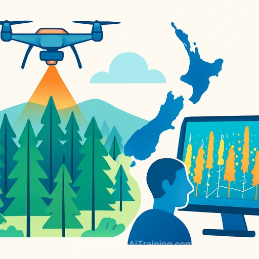
Managers now have a practical way to see planted radiata pine across most of New Zealand's North Island with clarity: AI combined with 3D airborne laser scanning (LiDAR). The approach distinguishes between large estates, small woodlots and new stands as young as three years old. It gives leaders a live picture of forest age, extent and volume - the inputs you need for better planning and more confident decisions.
What's new
Researchers from Australia and New Zealand combined deep learning on high-resolution aerial imagery with regional airborne laser scanning. The result: a spatially explicit, wall-to-wall description of planted forests that captures small-scale assets often missed in national datasets. As one researcher put it, "We combined deep learning-based forest mapping using high-resolution aerial imagery with regional airborne laser scanning data to map all planted forest and estimate key attributes."
Why it matters for managers
- Supply certainty: Stratify areas by age and volume to improve wood supply forecasting.
- Operational efficiency: Plan harvesting windows and logistics with precise stand boundaries.
- Capital allocation: Target roading and infrastructure investment based on up-to-date stock data.
- Risk management: Identify vulnerable sites before harvest to reduce landslide and debris flow exposure.
- Compliance and reporting: Support emissions accounting and audit readiness with traceable spatial data.
How it works
The system trains AI models on high-resolution aerial imagery to detect planted radiata pine. It then fuses those results with LiDAR to estimate stand attributes such as age and volume across all forest sizes. The map is kept current using satellite-based harvest detection and digital photogrammetry, enabling near real-time updates at scale.
Explore the AI-derived map here: forestinsights.nz.
Where it's been proven
The method was applied in New Zealand's Gisborne region, which provides public aerial imagery and LiDAR. This area was heavily affected by Cyclone Gabrielle in early 2023, making precise knowledge of stand location, age and condition essential for safe harvesting on steep terrain. The work was completed with researchers from Scion and Indufor Asia Pacific.
Use cases you can act on now
- Refine harvest schedules using stand-level age and volume for each woodlot.
- Prioritise roading and bridge upgrades where near-term harvest loads are highest.
- Model storm exposure by slope and stand age to set operational thresholds.
- Validate contractor plans against mapped boundaries to cut rework and disputes.
- Centralise reporting for boards, insurers and regulators with consistent spatial layers.
Risk and compliance
New Zealand's planted forests are core to export timber and fibre, and they also contribute to climate commitments through the emissions trading scheme. An accurate, continuously updated forest description simplifies auditing and supports credible carbon reporting. For policy context, see the New Zealand Emissions Trading Scheme overview: NZ ETS.
Metrics leaders should track
- Area by age class (ha) and volume by stand
- Harvested area vs. plan (monthly/quarterly)
- Roading and infrastructure ROI per harvested tonne
- Weather/storm exposure by slope class and stand age
- Audit-ready area and volume coverage (% of estate)
Getting started
- Inventory your available aerial imagery, LiDAR and satellite sources (public and private).
- Pilot one region with known harvest activity to validate detection accuracy.
- Integrate outputs into your harvest planning and logistics tools.
- Set a cadence for updates (e.g., monthly satellite checks, annual LiDAR refresh where available).
- Define governance: data owners, validation checkpoints and reporting standards.
What's next
The approach is directly applicable to Australia, where radiata pine is also widely grown. As more regions provide open aerial imagery and LiDAR, expect broader coverage and faster update cycles. The payoff is straightforward: fewer surprises, tighter plans and better capital discipline across the forestry portfolio.
Upskill your team
If you're building internal capability to manage AI-driven operations and reporting, explore practical training for coordinators, operations leads and business managers: AI Learning Path for Production Coordinators, AI for Operations, and AI Learning Path for Business Unit Managers.
Your membership also unlocks: