AI drone swarms map wildfire smoke in 3D for sharper air-quality forecasts
Wildfire smoke looks simple at a distance. Up close, it's a fast-moving flow of particles that shifts by the second and can move hundreds of miles. That complexity is exactly why forecasts break down and warnings arrive late.
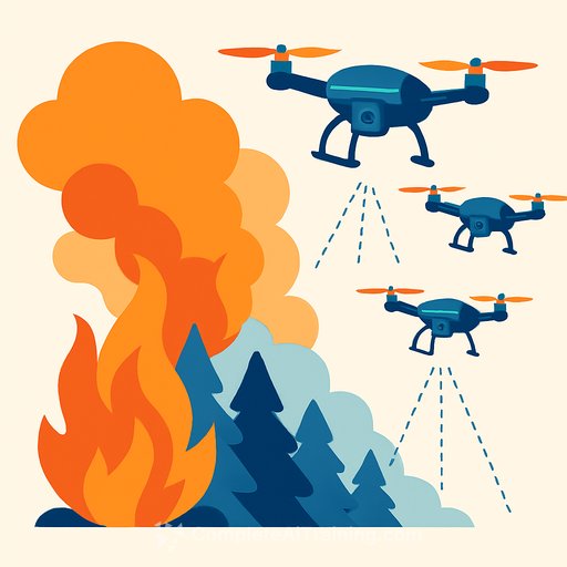
A research team at the University of Minnesota Twin Cities built an AI-driven drone swarm that detects smoke, flies into it, and reconstructs plumes in 3D. The result is time-sensitive, high-resolution data that feeds fire behavior and air-quality models with the detail they've been missing.
Why current tools miss the mark
Satellites and fixed sensors capture the big picture but lack the flexibility to sample evolving plumes at useful spatial and temporal scales. Lidar helps in select deployments, but coverage and cost limit its reach across rugged terrain and remote burns.
Field-ready, coordinated drones close that gap by capturing what matters most for forecasts: plume geometry, motion, and particle dispersion as conditions change.
The swarm, in brief
The system uses one manager drone and four worker drones. Each carries a 12 MP camera on a 3-axis gimbal, a 6000 mAh battery, an advanced flight controller, and an NVIDIA Jetson module for onboard smoke detection and path planning.
- Autonomy: Drones identify smoke in real time and reposition to capture optimal viewpoints.
- Coverage: Multi-angle imaging around the plume enables consistent 3D reconstructions.
- Cost-efficiency: Field deployments scale without satellite tasking or specialized fixed infrastructure.
From images to 3D plumes
Images are grouped by time slice and processed with a Neural Radiance Field (NeRF) pipeline to reconstruct the plume's volume and structure. With sequential reconstructions, the team computes direction, tilt, and dispersion speed-inputs that directly improve transport models and nowcasts.
Motion-centric variants like D-NeRF and RoDynRF were evaluated but struggled with low-texture targets like smoke and long training times. Capturing richer multi-view data in the field sidesteps those issues and speeds delivery of usable results.
What this unlocks for fire science
- Validation and calibration for physics-based models such as FIRETEC and QUIC-Fire.
- Time-series plume geometries to test dispersion assumptions and boundary conditions.
- Data assimilation for localized air-quality forecasting and exposure mapping.
- Operational insights for prescribed burns, where real-time plume tracking can guide tactical decisions.
Field results and broader use
Deployments have produced sequential 3D reconstructions-essentially a time-lapse of plume evolution. That supports faster hazard detection and more targeted public health responses.
The approach extends to volcanic ash, dust storms, and urban pollution events-any scenario where particle behavior in the air changes quickly and matters for policy or operations.
Next on the roadmap
The team is integrating fixed-wing VTOL platforms for flights exceeding one hour and runway-free launches, expanding coverage across remote forests and complex terrain. They are also exploring Digital Inline Holography to characterize particle size and type within the plume, tightening the link between optical reconstructions and aerosol composition.
Deployment notes for researchers and agencies
- Plan for synchronized capture: time-stamp alignment and consistent exposure settings improve NeRF quality.
- Calibrate cameras and gimbals before each mission to reduce reconstruction drift.
- Establish airspace deconfliction, visual observers, and geofencing for smoke penetration flights.
- Streamline ground-to-cloud pipelines so 3D outputs feed forecast systems within operational timelines.
- Document uncertainty: report reconstruction confidence with each time slice for model assimilation.
Why timing matters
From 2012-2021, roughly 50,000 prescribed burns were conducted in the U.S., and 43 escaped control in 2024 alone. Small particles can linger for days, affecting regions far from the burn site. With more than 40% of the U.S. population exposed to smoke risk, faster, higher-fidelity plume data can make forecasts and advisories more actionable.
For practitioners building similar AI pipelines
If you're developing perception and modeling stacks for field robotics or environmental sensing, you may find structured learning paths useful: Latest AI courses.
Your membership also unlocks: