AI Drones vs. Wildcat Mining: An Operations Playbook
Illegal artisanal and wildcat mining is scaling in sophistication and volume across gold-rich regions. As prices climb, the threat profile shifts from opportunistic trespass to organized, well-equipped crews that disrupt production, strain security, and damage communities and ecosystems.
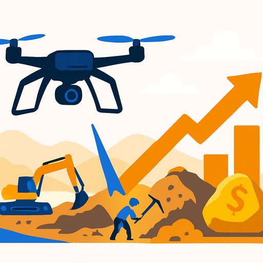
Operations teams need a surveillance model that sees more, reacts faster, and costs less to run over large areas. AI-enabled drone systems are delivering that shift with real-time detection, precise geo-coordinates, and coordinated response.
The Escalating Threat
Wildcat mining inside commercial concessions has expanded far beyond small artisanal activity. In West Africa, Ghana, Guinea, and Burkina Faso have seen sharp increases, driven by unemployment, land disputes, and foreign-backed operations. Local market prices reportedly topped $3,300/oz, raising incentives for illicit extraction.
The fallout is severe: weeks-long shutdowns, violent confrontations since late 2024, and lost national revenue through smuggling. Ghana alone is estimated to have lost more than 229 metric tons of gold between 2019 and 2023-close to $11 billion in value.
Environmental damage compounds the risk-mercury and cyanide use, deforestation, and habitat loss. For context on mercury risks in artisanal gold mining, see the UN Environment Programme's overview of ASGM impacts and mitigation efforts. UNEP: Artisanal and Small-Scale Gold Mining
Why Traditional Security Falls Short
Ground patrols struggle across dense vegetation, rugged terrain, and remote sites. Helicopter surveillance is costly and intermittent. Static checkpoints create blind spots that organized crews exploit.
AI-enabled aerial surveillance closes these gaps with persistent coverage, automated detection, and direct tasking of on-the-ground teams-without putting personnel in harm's way.
What These Systems Can Do
New platforms cover long distances, operate at higher altitudes, and stay stable in challenging weather. Expanded payloads carry high-resolution optical sensors, thermal imaging, and LiDAR for day/night detection.
Onboard AI analyzes visuals and sensor streams in real time-differentiating human movement, vehicles, animals, and environmental change. The result: fewer false alarms and faster, more targeted responses.
Proof on the Ground: Ghana Case Study
At Gold Fields' Tarkwa mine in Ghana, drones scan a 210-square-kilometer concession in single sorties and flag anomalies. When an alert triggers, a 15-person team is on-site in about 20 minutes.
Discoveries have included diesel water pumps and local processing units set up inside concession boundaries. Ghana's Minerals Commission is building a centralized AI analysis room to process feeds from 28 drones across hot spots, with excavator trackers that can remotely disable machines operating outside authorized zones. For updates and policies, see the Minerals Commission. Ghana Minerals Commission
Operational Gains That Matter
- Coverage: Monitor vast, complex terrain faster than ground teams or manned aircraft.
- Safety: Reduce exposure for guards and operators in high-risk zones.
- Costs: Lower ongoing surveillance costs versus helicopters and large patrol units.
- Speed: Shorten the path from detection to interdiction with exact coordinates and visual confirmation.
Inside the Tech Stack
Computer vision models process high-resolution video, LiDAR, and thermal data at the edge. Object recognition and pattern analysis separate legitimate activity from suspicious behavior in real time.
Photogrammetry and structure-from-motion rebuild 3D terrain models from 2D images, highlighting new cuts, water diversions, or tracks. Convolutional Neural Networks classify equipment and flag unauthorized activity for review.
Autonomy: From Path Planning to SLAM
Advanced path planning optimizes routes for wind, terrain, and obstacles, adjusting in-flight to maintain coverage. SLAM builds and updates maps while tracking precise location in unfamiliar areas.
Decision systems adapt to sudden weather, new obstacles, or fresh intelligence. Reinforcement learning improves patrol patterns and response logic over time.
Hardware, Edge Compute, and What's Next
Platforms combine LiDAR, thermal sensors, GPS, and high-performance onboard processors. Specialized AI chips enable on-drone analysis, reducing latency and reliance on continuous connectivity.
Expect longer flight times, better sense-and-avoid, and coordinated multi-drone missions. Key challenges remain: consistent data quality, flight endurance limits, complex regulatory requirements, and cybersecurity as systems become more connected.
Implementation Blueprint for Operations Leaders
- Map risk: Overlay prior incursions, access routes, waterways, settlements, and blind spots.
- Define patrol logic: Set geofences, no-fly zones, and tiered alert thresholds (people, vehicles, excavation).
- Stand up a control cell: Centralize feeds, assign watch officers, and codify escalation paths.
- Integrate response: Pre-plan intercept routes; pair each alert type with a response team and playbook.
- Close the loop: Require post-incident reviews to retrain models and refine SOPs.
- Engage stakeholders: Coordinate with regulators, local communities, and concession neighbors.
- Train your team: Build skills in UAS ops, AI alert triage, evidence handling, and data governance. For structured upskilling, see AI courses by job. Complete AI Training
Metrics That Show ROI
- Time to detection and time to intercept
- False positive and false negative rates
- Area covered per flight hour; cost per square kilometer monitored
- Incident frequency and recurrence near prior hot spots
- Assets seized and equipment disabled
- Production days preserved; remediation costs avoided
Vendor Due Diligence Checklist
- Detection accuracy for people, vehicles, and excavation signatures (day/night)
- Sensor suite options (RGB, thermal, LiDAR) and endurance in your terrain and climate
- BVLOS readiness, geofencing, and compliance with local aviation rules
- APIs for VMS, CAD, incident management, and mapping tools
- Edge processing capability, offline modes, and bandwidth requirements
- Data security: encryption, access control, audit logs, and data residency
- Failsafes: return-to-home, link loss behavior, collision avoidance, and redundancy
- Service model: spares, maintenance, battery cycles, and training
Risks and Compliance to Address Early
- Regulatory approvals for operations, especially BVLOS and night flights
- Privacy and human rights policies for video capture and data retention
- Cybersecurity hardening for drones, controllers, and control room networks
- Clear legal frameworks for equipment tracking and remote disable protocols
- Community engagement to reduce conflict and improve reporting
Final Take
Illegal mining will keep adapting. So should your security model. AI-enabled drones give operations leaders the visibility, speed, and precision needed to protect concessions, people, and production-at a cost that scales.
The priority now is execution: pilot fast, measure outcomes, standardize SOPs, and scale what works.
Your membership also unlocks: