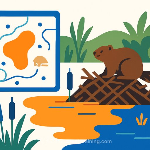
AI Predicts Beaver Pond Size: Practical Metrics for Restoration and Risk Management
Beaver dams do more than slow a stream. They build wetlands, store water, blunt floods, and create green corridors that persist through drought and fire. The hard part for managers has been predicting which sites will hold broad wetlands and which will fill a shallow pool.
A new study in Communications Earth & Environment mapped 1,200+ beaver ponds across Colorado, Wyoming, Montana, and Oregon using high-resolution aerial imagery and machine learning. Three variables explained nearly three-quarters of pond-size variation: dam length (strongest), height of nearby woody vegetation, and stream power. The result: a consistent scaling relationship that gives practitioners a straightforward way to estimate pond area from dam geometry and local conditions.
Key Finding: Dam Length Is the Lever
The study confirms what field ecologists have long suspected: longer dams store more water. By quantifying that relationship, teams can estimate pond area-and by extension, water storage-before a single post is driven for a beaver dam analog (BDA) or a relocation is planned.
"Based on the dams that people build, we could possibly estimate their pond area behind the dam," said Luwen Wan, the study's lead author. That estimation translates directly to hydrologic and ecological impact planning.
Why This Matters for Science and Operations
Most existing tools estimate how many dams a stream can support, not how much water those dams will hold. This work shifts focus to capacity and footprint-critical for drought buffering, habitat creation, and flood management.
"Any advancement that we can make in understanding the drivers behind where and when and how big and how much beavers are going to build is really valuable," said Jessie Moravek of the University of Minnesota's St. Anthony Falls Laboratory. "It tells us what tools we need to be looking at on a local scale to understand how beavers are going to make a local impact."
What the Model Prioritizes
- Dam length: Primary predictor of pond area.
- Woody vegetation height: Proxy for building material and bank stability.
- Stream power: Controls whether a dam holds or fails under flow.
Climate variables (precipitation, temperature) were weaker predictors at the pond scale, likely due to coarse datasets and the dominant role of local geomorphology and hydraulics. As Cherie Westbrook of the University of Saskatchewan notes, "You only have so much physical space that certainly can be flooded by beaver dams. Beavers can only build a dam so large."
Field-to-Model Workflow You Can Use
- Site screening: Identify narrow valley sections with stable banks, accessible woody vegetation, and manageable stream power (based on slope and discharge).
- Measure or design dam length: Use existing dam geometry or target BDA span across the active channel and low floodplain.
- Estimate vegetation height: From LiDAR, UAV photogrammetry, or field inventory focusing on willows and cottonwoods.
- Approximate stream power: Combine slope, bankfull width, and discharge estimates to flag high-energy reaches where failure risk increases.
- Apply scaling: Use the dam-length-to-pond-area relationship to forecast pond footprint and storage. Run scenarios for low, median, and high flows.
- Plan mitigation: Where roads, culverts, or cropland are nearby, design flow devices, set-back fencing, or selective tree protection.
- Monitor and adapt: Track pond area seasonally; update designs or add BDAs upstream/downstream to distribute energy and storage.
Benefits-and the Tradeoffs You Must Plan For
Larger ponds protect beavers from predators, buffer ice impacts, and increase safe access to forage. At the system scale, more stored water can reduce drought stress and moderate flood peaks. "If you are storing more water in the area, you're automatically protecting against drought and also the spread of wildfire," said Westbrook.
There are real risks. Ponds can inundate farmland, plug culverts, and fell valuable trees. In Alaska's Arctic, expanding ponds have been linked to faster permafrost thaw, greenhouse gas release, and pressure on subsistence fisheries. Predictive modeling of pond size and flood extent helps reduce these impacts before they happen.
Limitations to Keep in Mind
- Seasonal bias: Summer imagery can miss ponds under canopy or seasonal dynamics.
- Climate data resolution: Coarse grids blur local effects; terrain and hydraulics dominate at site scale.
- Transferability: The scaling held across multiple ecoregions, but always validate with local measurements and pilot installations.
Implementation Playbook for Agencies and NGOs
- Prioritize reaches where predicted pond size meets goals for water storage, habitat, or fire refugia.
- Design BDAs to target dam length thresholds that achieve desired pond area without over-topping infrastructure.
- Stage projects as modular networks-several smaller structures can outperform a single oversized dam in high-energy reaches.
- Pair with policy (e.g., setback guidance, culvert retrofits, tree-wrapping programs) in agricultural or peri-urban zones.
What's Next for Research
Researchers highlight two frontiers: time and subsurface processes. How long do dams persist? How much groundwater do they store? How do networks evolve through construction, collapse, abandonment, and renewal?
Expect expanded AI mapping, better integration of LiDAR and hydrologic records, and pond-lifecycle modeling tied to flow regimes. As Moravek notes, beavers are adaptable and can persist through droughts, floods, and fires-often creating refuges for many species along the way.
Resources
- Communications Earth & Environment (journal hosting the study)
- NOAA Fisheries: Beaver Restoration (guidance and background)
Your membership also unlocks: