AI-Powered Soil Moisture Mapping Tool Benefits Government Land and Fire Management
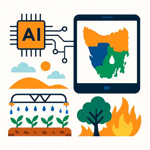
A new AI-driven soil moisture mapping tool developed by University of Sydney researchers offers practical benefits for farmers, irrigators, government agencies, and fire authorities. The tool provides near real-time, high-resolution soil moisture data across Tasmania, supporting better decision-making in irrigation, fuel reduction burns, and pasture management.
How the Tool Works
Lead developer Marliana Tri Widyastuti, a Ph.D. candidate at the Sydney Institute of Agriculture, explains that the system combines satellite data, weather forecasts, soil and land maps, and deep learning techniques. It integrates real-time data from 39 in-ground soil moisture probes alongside local rainfall readings. This fusion of data creates a clear, accurate soil moisture picture across most of Tasmania.
Professor Budiman Minasny, an expert in agricultural technology, highlights that the tool monitors multiple soil layers up to 80 cm deep, producing daily soil moisture maps at an unprecedented resolution of 80 square meters. This level of detail helps land managers plan irrigation schedules, optimize water use, and prepare for fire risks with greater precision.
Current Use and Impact
The interactive soil moisture maps are freely accessible online and have already been adopted by the Department of Natural Resources and Environment Tasmania (NRE Tas). Dr. Mathew Webb, a senior spatial scientist at NRE Tas, notes that the tool enhances environmental management by providing detailed information on drought trends and moisture changes, especially in sensitive dairy farming areas such as King Island.
Fire management teams are also exploring the tool for fuel reduction burn planning. The precise moisture data supports better timing and safety assessments for burns in national parks and forests, contributing to more effective fire risk management.
Collaboration and Future Potential
The tool builds upon over ten years of soil science research at the University of Sydney, in collaboration with Tasmanian agencies and national data providers. This partnership demonstrates how applied science can directly support food security, livestock protection, and adaptation to variable rainfall patterns.
Widyastuti, who originally developed the tool during a Masters scholarship funded by the Indonesian government, hopes it will benefit rural communities worldwide. Beyond Tasmania, the tool could improve irrigation in food-producing regions, assist with drinking water catchment management, and support fire protection efforts in vulnerable ecosystems.
She has published the code and data openly to encourage other agricultural scientists to apply this technology globally, fostering wider adoption and innovation.
Learn More
- Access the soil moisture maps and related resources through official Tasmanian government channels.
- Read the detailed research publication: Mapping near-real-time soil moisture dynamics over Tasmania with transfer learning, SOIL (2025).
For government professionals interested in AI applications for environmental and resource management, exploring relevant AI training can be beneficial. Visit Complete AI Training - Latest AI Courses to find programs tailored to practical AI use cases.
Your membership also unlocks: