
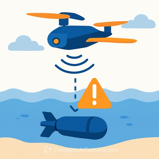
Scientists at the University of Miami Rosenstiel School of Marine, Atmospheric, and Earth Science have developed an airborne imaging system that uses artificial intelligence to detect unexploded ordnance in shallow coastal waters. The approach, published in the April issue of Frontiers in Marine Science, reliably identifies munitions even when they are partially buried under sediment, biological growth, or debris - conditions that have long frustrated traditional detection methods.
The work addresses a stubborn global problem. Unexploded ordnance, or UXO, in waters less than 10 meters deep poses ongoing risks to coastal communities, marine ecosystems, and infrastructure. These hazards are widespread, yet shallow-water detection has remained technically difficult. Acoustic surveys struggle to cover large areas efficiently, and optical imaging is routinely distorted by surface waves and water conditions.
How multispectral sensing and AI work together
The research team, led by Ved Chirayath, director of the Rosenstiel School's Aircraft Center for Earth Studies, conducted airborne missions over a test site at Broad Key in the northern Florida Keys. They deployed inert munitions and decoy objects across two locations, then imaged them with drones carrying two NASA-developed technologies. Fluid Lensing corrects the optical distortions created by ocean surface waves, producing high-resolution seafloor imagery. MiDAR - short for Multispectral Imaging, Detection, and Active Reflectance - adds active multispectral illumination across multiple wavelengths, giving the system data beyond what passive imaging can capture.
The resulting imagery trained a machine learning model to distinguish munitions from surrounding objects - a task that requires more than simple pattern matching in cluttered marine environments. Both sensing approaches achieved strong detection performance with minimal false positives, though active MiDAR sensing produced the highest precision. The system successfully identified all deployed targets, even after weeks of biofouling and sediment accumulation made visual detection considerably harder. This kind of AI for Science & Research illustrates how domain-specific sensing paired with tailored algorithms can outperform generic approaches.
What the study found
"Unexploded ordnance in shallow waters remains a serious global challenge," said Chirayath, the study's lead author and Vetlesen Endowed Chair of Earth Sciences in the Department of Ocean Sciences. "Our results demonstrate a scalable, airborne solution that can help improve detection accuracy and support safer coastal environments."
The Research showed that the system maintained its detection capability as conditions degraded. The team noted that one decoy - a black nipple dummy target - was correctly excluded from UXO classification, demonstrating the model's ability to avoid false positives against objects that superficially resemble ordnance. Detection held across complex backgrounds including seagrass, sand, and rock.
Limits and next steps
The findings are promising, but the researchers caution that additional testing is needed. Expanding the system to work reliably across different environments and with varying munition types remains the next milestone. Shallow coastal waters differ dramatically in clarity, bottom composition, and biological activity from one region to another, and a model trained in the Florida Keys will need validation elsewhere before operational deployment.
Why this matters for science and research professionals
For researchers working at the intersection of remote sensing, marine science, and machine learning, this study offers a concrete template: pairing physics-based optical correction with active multispectral sensing, then training models on that combined data stream. The method sidesteps a common failure mode in environmental AI - models that perform well in clean training conditions but collapse under real-world noise. Here, the noise was the point, and the system handled it. The same integration pattern could apply to other shallow-water imaging problems, from habitat mapping to infrastructure inspection.
Your membership also unlocks: