BRIN Pushes AI in Remote Sensing to Deliver Faster, Precise Data for Society
Indonesia's National Research and Innovation Agency (BRIN) is moving to apply AI across remote sensing workflows to turn satellite imagery into real-time, interpretable data for public needs. During a visit to the Samaun Samadikun Science and Technology Center in Bandung on December 24, 2025, BRIN Head Arif Satria reviewed AI-enabled systems and called for immediate scale-up.
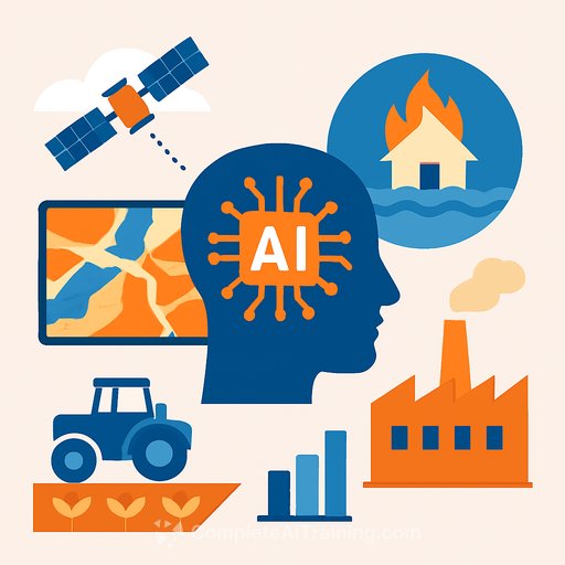
Focus areas are clear: disaster management, agriculture, and industrial applications. The goal is shorter time-to-insight and higher accuracy where it matters most.
Why it matters
Speed and precision save lives during disasters and reduce losses in agriculture and industry. AI can turn raw imagery into risk maps, change detection layers, and decision-ready outputs-without waiting days for manual interpretation.
"Satellite imagery should not just capture pictures but be able to directly interpret analytical insights," Arif said.
What BRIN is building
BRIN is accelerating AI pipelines that convert satellite imagery into structured, analytical products: before/after overlays, segmentation maps, and time-series indicators. Arif highlighted the value of 3D AI modeling approaches, referencing work from the United Nations Development Programme that supports pre- and post-disaster analysis.
United Nations Development Programme initiatives show how 3D AI can improve situational awareness and planning. The same thinking applies to agriculture and industrial monitoring-faster signals, fewer blind spots.
Collaboration and the 2026 agenda
AI Research Courses are closely aligned with BRIN's inherently multidisciplinary approach-remote sensing, computing, electronics, telecommunications, intelligent mechatronics, and data science. Arif called for tighter collaboration between the Electronics and Informatics Research Organization (OREI) and other BRIN units to accelerate the 2026 research agenda.
He urged researchers to go deeper on projects tied to societal needs. That means tighter loops with end users, faster iteration, and clear criteria for success.
Infrastructure first
"The nation's advancement is measured by technological progress, technological progress is measured by research, and research is reflected in research facilities and themes," Arif said. Research capacity-labs, compute, data access, and testing grounds-will define throughput and quality.
Expectation: infrastructure that supports high-frequency data ingestion, reproducible pipelines, and field validation.
User-oriented research
Arif emphasized that research must be driven by user needs-farmers, local governments, and industries that depend on timely, reliable data. He called for frequent engagement so outputs match operational realities and deliver measurable benefits.
National priorities
Beyond remote sensing, priorities include energy, water, health, agriculture, and disaster management. Arif also pointed to the electronics sector and asked researchers to map the competitive landscape, markets, and areas where new information can translate into national innovation.
For researchers: practical actions
- Co-design with users: define use cases, latency needs, and decision thresholds up front.
- Build reliable datasets: maintain clear ground truth, metadata standards, and validation protocols.
- Optimize for deployment: model efficiency, edge inference where needed, and clear MLOps practices.
- Set metrics that matter: accuracy by class, time-to-insight, false alarm rates, and field-confirmed outcomes.
- Plan for operations: versioning, monitoring, failover, and clear handoffs to agencies and industry.
- Align with 2026 priorities: map projects to disaster response, agriculture, energy/water, health, and electronics.
Aerospace link: PT Dirgantara Indonesia
Before visiting KST Samaun Samadikun, Arif toured PT Dirgantara Indonesia (PT DI) to review the N219 aircraft and other designs. He voiced optimism that BRIN-PT DI collaborations will support the recovery of Indonesia's aerospace sector.
BRIN Deputy Head Amarulla Octavian said decisions for future research-especially in aviation and electronics-informatics-are underway. "Our focus is on research that is urgently needed and whose results can be immediately felt by society," he noted.
What to watch next
- Pilots that deliver faster disaster assessments and early warnings.
- Field-validated agriculture dashboards tied to yield, soil moisture, and pest risk indicators.
- Industrial monitoring use cases with clear ROI and service-level expectations.
- Commitments on compute, data access, and shared testing environments to support scale.
If you're upskilling teams for geospatial AI, data pipelines, or evaluation workflows, explore the AI Learning Path for Training & Development Managers.
Your membership also unlocks: