Integrating Drones, AI, and Smartphones Can Accelerate Disaster Victim Search Operations
As of Wednesday (Dec. 10), Indonesia's National Disaster Management Agency (BNPB) reported 969 deaths and 252 people missing from flash floods and landslides across Aceh, North Sumatra, and West Sumatra. The search is slow. The gap is clear: we need faster detection and tighter coordination on the ground.
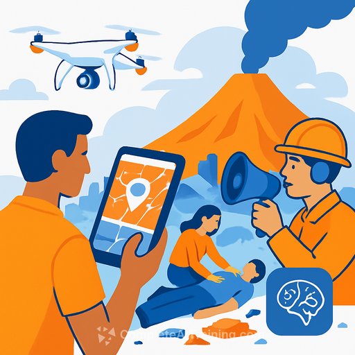
An AI expert from Universitas Gadjah Mada (UGM), Dr. Andi Dharmawan, points to a practical path forward: pair drones with computer vision and connect them to the smartphones already in every SAR team's pocket. This mix has worked elsewhere and can work here-if we integrate it well and prove it in the field.
What's working elsewhere
During Hurricane Harvey in the United States, drones streamed aerial video to speed evacuations and route decisions. In Australia, a UAV dropped flotation devices and helped save two teenagers swept out to sea-proof that simple payloads and fast response can change outcomes on the spot.
- Several countries, including Japan and Switzerland, deploy drones with thermal cameras and AI to spot human heat signatures through debris.
- In Indonesia, drones are in use, but AI and real-time workflows are still early. The opportunity is in integration and downstream execution.
See the Australia drone rescue case (BBC)
BNPB official site
Indonesia's operational reality
Our terrain is tough: wide flood zones, dense forests, steep hills, and dead zones with no signal. These conditions degrade drone stability and make AI detections harder-murky water, occlusions, low light, and heavy debris can all mask victims.
The other bottleneck is workflow. Detections from the air only matter if they reach ground teams, fast, with clear coordinates, snapshots, and a simple way to verify and act. That means a well-structured system, not just gadgets.
Practical stack you can deploy now
Start simple. Stable drones with high-quality real-time video already pay off. Then add lightweight AI that flags frames for human review. The goal is to cut review time, not replace people.
- Drones: visual + thermal payloads, 30-45 min flight time, quick-swap batteries, rain tolerance.
- Connectivity: LTE/5G where available; mesh or point-to-point radios as backup; store-and-forward when offline.
- Ground station: live map with flight paths, geofenced no-fly areas, and timestamps on every observation.
- AI assist: on-drone or edge device models to highlight likely humans/heat; confidence score + snapshot + GPS.
- Smartphone app for SAR: push pin-drops with coordinates, image thumbnails, and a "confirm/clear" workflow.
- SOPs: triage queue for AI alerts, human-in-the-loop verification, escalation rules, and a clear handoff to field teams.
- Evidence log: auto-archive detections, actions taken, and outcomes for after-action review.
Field trials: make it real before you scale
Even advanced tools stumble without local testing. Indonesia's fast-changing weather and terrain demand trials that mirror real operations.
- Test sites: urban flood zone, river corridor, and forested hillside.
- Metrics: time-to-first-sighting, confirmed finds per flight hour, false positive rate, area coverage per hour, battery swap time.
- Comms plan: single incident channel, call signs, and check-in intervals across drone teams and SAR units.
- Airspace rules: deconfliction by altitude/time blocks, no-fly zones, lost-link procedures, and night ops standards.
- Training: pilots, visual observers, AI monitors, and field liaisons; run short, frequent drills.
- After-action: review detections vs. confirmations, tune models, update SOPs, and retrain where needed.
Integration and command
- Common operating picture: shared map with flood extent, hazards, last-seen points, and live aircraft status.
- APIs and formats: KML/GeoJSON for pins, RTSP/WebRTC for video, simple REST hooks from AI to the EOC.
- Clear roles: flight lead, visual observer, AI screen lead, SAR liaison, and safety officer.
- Resilience: portable power, spare radios, offline map tiles, and a fallback brief if data links fail.
- Privacy: blur faces in shared media, restrict public sharing, define retention windows for imagery.
Scaling up, step by step
Once the basics work, move to coordinated multi-drone sweeps to cover large areas faster. That requires airspace deconfliction, takeoff sequencing, and a dispatcher who balances search grids with battery cycles.
Partnerships matter. Research at universities (including UGM) is strong, but it needs support to move from lab to field with BNPB, BASARNAS, and local governments. Start small, prove value, then expand. Steady progress saves lives.
Quick next steps for operations leaders
- Pick two priority zones and run a 7-10 day pilot with one thermal drone and one edge AI device.
- Stand up a simple alert pipeline: drone → edge AI → EOC map → SAR app.
- Measure the four numbers that matter: time-to-first-sighting, confirmations per hour, coverage per hour, and false alerts.
- Lock in weekly drills and a 30-minute after-action review after each mission.
Skills and training
If your team needs fast upskilling in AI workflows for field operations, review focused research and training materials and plan short, practical blocks between drills.
Bottom line: use drones for eyes, AI for triage, and smartphones for action. Keep the loop tight, measure everything, and iterate in the field until it sticks.
Your membership also unlocks: