How a HAI Seed Grant Helped Launch a Disease-Fighting AI Platform
Field ecology is slow, hot, and brutally manual. In Senegal, Stanford researchers and local partners stood in chest-deep water for hours, uprooting vegetation, counting snails, and logging data across 30+ sites. Important work-but too small to guide decisions at national scale.
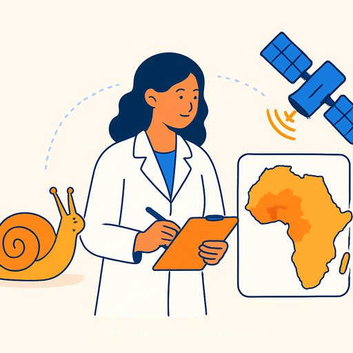
With a modest seed grant, that grind turned into a machine learning platform that maps schistosomiasis risk across entire regions using field data, drones, and satellites.
From Muddy Quadrats to Regional Maps
The team-led by Giulio De Leo, professor in the Stanford Doerr School of Sustainability and co-director of the Stanford program for Disease Ecology in a Changing World, and research associate Andy Chamberlin-wanted to pinpoint environmental drivers of schistosomiasis, a parasitic disease of poverty that affects more than 250 million people, mostly school-age children in sub-Saharan Africa.
On the ground, crews sampled small, fixed quadrats, removed vegetation, captured snails, and processed every sample back in the lab. The outcomes were clear: certain freshwater vegetation types consistently predicted higher infection risk. The question was scale: how do you carry that signal from a one-meter square to an entire watershed?
The $50,000 Bet That Scaled
A 2018 seed grant from the Stanford Institute for Human-Centered AI funded a practical test. De Leo brought in AI researchers Zac Liu and John Bauer to train convolutional neural networks to identify medically relevant snails and vegetation from images. That proof of concept unlocked a Woods Institute seed grant and, later, $2.5 million from the National Science Foundation's Ecology and Evolution of Infectious Diseases program.
"I cannot overstate how catalytic this early support has been," De Leo says. "Without the bridge funds provided by HAI, which gave us the freedom to explore this novel application, none of this would have been possible."
Inferring Snails by Satellite
Low-resolution satellite imagery was too coarse to trace the team's field signals. Chamberlin closed the gap with drone flights over water access points, capturing imagery where individual vegetation types could be separated and labeled. That created the link between species-level field data and pixel-level features.
"We were able to extrapolate what we know from really fine-scale field work to these larger drone images with a high degree of accuracy," Chamberlin says. "And then we could use that to evaluate satellite imagery over the same time period and a much broader area, which enabled us to do more regional-scale analysis and monitoring."
Liu and Bauer then built tools that combined three streams-field surveys, drone mosaics, and satellite scenes-into risk surfaces. The result: a workflow that flags likely infection hotspots and helps prioritize surveillance and public-health outreach.
Investing in Local Capacity
The work runs through long-standing partnerships with Station d'Innovation Aquacole and the Université Gaston Berger (UGB) in Saint-Louis, Senegal. Chamberlin, with UGB professors Maïssa Mbaye and Cheikh Bamba Dione, led a week-long workshop training master's and graduate students on image processing and deep learning for imagery analysis.
This is more than a single-disease project. The same skills support crop estimation, watershed monitoring, and early-warning systems that depend on integrating field, drone, and satellite data.
Near-Term Extensions
One follow-on effort, supported by the Stanford Sustainability Accelerator, uses drone imagery to estimate rice production in the lower Senegal River basin. The methods translate cleanly: label at high resolution, learn the relationship to coarser imagery, then scale.
Technically, the stack is flexible: supervised learning on labeled vegetation, domain adaptation from drone to satellite, and fusion of multi-date scenes for stability through seasonal change. The goal is consistent, decision-ready maps-not bigger models for their own sake.
Beyond Snails: Forests and Mosquitos
The team is applying the same logic elsewhere. In Indonesian Borneo, they fused detailed lidar maps of rainforest structure with satellite imagery to estimate canopy height across broad areas-useful for tracking deforestation and informing conservation and land-management policy.
Another project in Indonesia, led by Joelle Rosser and Desiree LaBeaud at Stanford School of Medicine, uses machine learning to identify discarded tires in urban settings. Tires make prime breeding sites for mosquitos, raising the risk for malaria and dengue.
What Researchers Can Reuse
- Start with a clear ecological signal. Here: specific vegetation types correlate with schistosomiasis risk over multiple years.
- Collect tiered data. Pair fine-grained field labels with drone imagery to create a high-resolution training set; then connect that to satellites for coverage.
- Bridge resolutions with supervised learning. Train CNNs on drone labels; transfer to satellite bands and indices to generalize.
- Integrate time. Use multi-date satellite scenes to smooth noise from water level, turbidity, and seasonal growth.
- Validate continuously. Hold out sites and seasons; compare against independent infection data where available.
- Invest locally. Workshops and shared codebases reduce bottlenecks and make models maintainable on the ground.
Impact Where It Matters
This platform doesn't replace lab work; it extends it. By encoding field knowledge into models, the team can monitor risk at scale, guide treatment campaigns, and redeploy field crews where new hotspots emerge.
As Chamberlin puts it: "It's one thing to capture images, but it's another to really analyze them… Combining these drone platforms with machine learning has been a journey. We've learned a lot. And there's much more to learn - and it started with snails in muddy water."
Resources
Your membership also unlocks: