When it rains, it pollutes: Inside D4RUNOFF's AI-powered risk maps for smarter urban water management
Environment | 19 February 2026
Urban runoff is a daily, mostly invisible risk. Every rainfall washes heavy metals, tire residues, hydrocarbons, and other contaminants off roads and rooftops and into waterways-often without treatment.
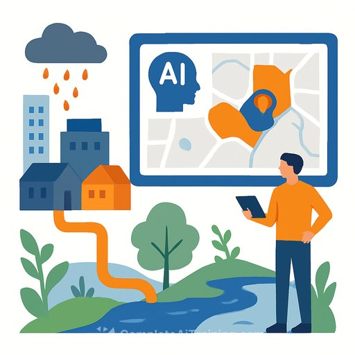
D4RUNOFF is making this problem visible and manageable. The project is turning complex data into clear, climate-informed risk maps so city teams can spot pollution hotspots and plan practical nature-based solutions (NBS) with confidence.
The management problem urban runoff creates
Runoff pollution is diffuse, event-driven, and highly variable. It shifts by season, land use, and traffic intensity, which makes blanket policies ineffective and reactive maintenance expensive.
Most municipalities don't have a unified view that connects rainfall data, land use, drainage, and pollutant thresholds. D4RUNOFF changes that by combining monitoring data, models, and visual tools into one AI-assisted platform that supports day-to-day decisions.
What D4RUNOFF is building
The AI-assisted platform brings core planning and operations tasks into one place:
- Pollutant-specific risk maps
- NBS planning tools
- Monitoring data integration
- Climate-adjusted rainfall projections
- Scenario comparison features
These tools are now live in three pilots: Odense (Denmark), Santander (Spain), and Pontedera (Italy). The goal is consistent: make risk visible, comparable, and actionable at the neighborhood level.
What you can do with it
Register and try out the AI-assisted platform. It helps utility operators, planners, and policymakers:
- Identify pollution hotspots
- Compare neighborhoods visually
- Explore potential green infrastructure interventions
- Evaluate how risks may change under future rainfall patterns
Because risk layers sit next to NBS options like rain gardens, permeable pavements, green roofs, and wetlands, teams can connect diagnosis with action in the same session. For background on NBS, see the European Commission's overview of nature-based solutions here.
Who's building the risk maps
At the core is Mitiga Solutions, a Barcelona-based climate risk intelligence SME and member of the D4RUNOFF consortium. They designed the project's risk-mapping methodology to translate raw environmental data into intuitive decision tools for city teams.
How the data becomes a clear risk picture
The methodology integrates open city datasets (surface types, drainage, land use), rainfall records and climate projections, field monitoring, environmental safety thresholds, plus hydrological and pollutant transport models. The output is a spatial risk index that shows where concentrations are likely to exceed safety levels and how often exceedances are expected-today and under future rainfall.
Maps can be viewed by individual pollutant (e.g., heavy metals, tire-derived substances) and as a combined multi-pollutant layer. Instead of technical charts, teams get visual, color-based signals and probabilities that make comparison across districts quick and repeatable.
Field validation: Odense 2025
Models only help if they reflect the street. In spring and summer 2025, partners VCS and the University of Copenhagen ran a large citizen science campaign in Odense. Volunteers collected over 300 runoff samples across different storms and urban areas.
The results confirmed key patterns: higher pollutant concentrations in the city center and a strong link between tire-related substances and road traffic intensity. These measurements were then used to calibrate the model so the risk maps track real rainfall dynamics and surface conditions. That "ground truth" boosts trust in the platform's outputs.
What the maps tell your team-fast
- Where should we look first? Hotspot identification helps crews prioritize inlet inspections, maintenance at critical nodes, small pilot fixes, and targeted monitoring campaigns.
- How often is pollution likely to occur? The maps don't stop at presence/absence. They show probability and recurrence with clear color scales, so you can see if an area spikes once a year or multiple times a season-and how frequency shifts with heavier storms.
- What NBS could work here? Because NBS tools are built in, you can test rain gardens, constructed wetlands, permeable pavements, and green corridors and compare projected reductions in pollutant transport before investing.
Why this matters for budgets and timelines
Diffuse pollution usually hides in the "miscellaneous" line of a budget. With clear risk maps, you can justify targeted spend, set maintenance priorities, and stage NBS rollouts by impact. That means fewer blanket upgrades, more precise interventions, and faster wins that build momentum.
The platform also supports scenario planning. You can compare today's risk with climate-adjusted rainfall projections to understand how operational needs and capital plans may shift over the next decade. For broader context on stormwater and diffuse pollution, the European Environment Agency offers an overview here.
What's next for D4RUNOFF
Mitiga Solutions is finalizing Version 2.0 of the risk maps. Updates include stronger validation and expanded pollutant categories where reliable datasets exist.
The objective stays simple: usable, trustworthy, climate-informed maps that support everyday municipal decisions-from scheduling maintenance to planning a street redesign.
Manager's takeaway
If you lead operations, planning, or policy, two actions move the needle: make risk visible and tie it directly to interventions. D4RUNOFF does both in one environment, so your team can move from "we think" to "we know" and act with confidence.
If you're building skills to lead AI-enabled environmental programs, explore AI for Management for practical ways to integrate analytics into planning and operations.
Your membership also unlocks: