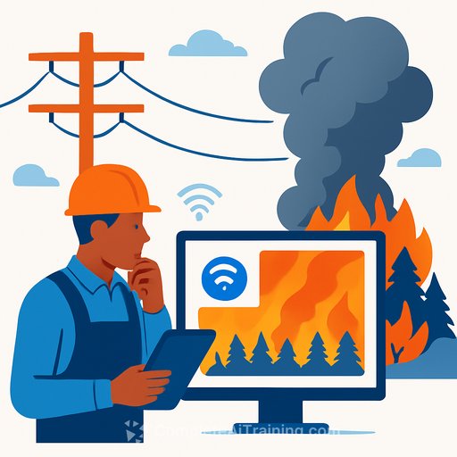
Can AI stop wildfires before they start?
Wildfire prevention used to mean rigid inspections and broad emergency shutoffs. Now utilities are testing a sharper approach: AI to decide what to inspect, where to act, and how fast to respond before a spark turns into a runaway event.
The need is obvious. In 2025, the U.S. saw more than 77,000 wildfires and over five million acres burned. Dry seasons run longer. Weather, vegetation, grid hardware, and human activity all stack uncertainty-and traditional workflows can't keep up.
From blunt schedules to targeted vegetation intelligence
Overstory, based in Amsterdam, builds AI models to flag hazard trees near electric lines and pinpoint fuels such as dead grasses and shrubs. Instead of walking every mile or flying lidar on a fixed cadence, utilities get a map-based view of height, encroachment, health, mortality, and moisture using high-resolution satellite imagery.
The aim is prioritization, not replacement. "We're giving our suggestions based on our analysis. But ultimately, the decisions are made by humans in the field who are standing in front of the trees," says Fiona Spruill, CEO of Overstory.
Early results show signal. Pacific Gas and Electric reported a nearly 50 percent drop in vegetation-suspected ignitions in 2025 versus the prior year, according to Andrew Abranches, vice president of wildfire mitigation. The trade-off: satellite updates come in snapshots, not a live feed, so there's inherent uncertainty and the need for human review, as Overstory's Sonya Sachdeva notes.
24/7 detection: cameras, AI, and human verification
On the detection side, Pano AI deploys 360-degree pan-tilt-zoom cameras that scan continuously for daytime smoke and nighttime heat. Streams are analyzed in the cloud and fused with geostationary satellite data and emergency-service feeds. Alerts route to command hubs such as PG&E's Hazard Awareness Warning Center, where analysts verify before dispatch.
"Once a human has verified that this is indeed a fire, they push out an alert by text and e-mail," says Pano AI CEO Sonia Kastner. The human-in-the-loop filters look-alikes-fog, dust, clouds-that can trick algorithms.
Arizona Public Service reports that Pano AI has often beaten 911 calls by 10-25 minutes, according to forestry and fire mitigation director Scott Bordenkircher. Line-of-sight still matters: smoke needs to rise into view, and coverage is limited to where cameras are installed.
These ideas grew out of academic work like ALERTCalifornia, a UC San Diego-led program that helps local departments confirm fires in real time. "We've cut down the response time dramatically," says principal investigator Neal Driscoll. The goal is simple: catch small fires while they're still small.
How utilities can operationalize this now
- Prioritize vegetation work: fuse satellite-derived tree metrics with existing GIS, rank spans by failure and fuel risk, and schedule crews accordingly.
- Instrument high-risk areas: deploy 360-degree cameras with clear sight lines, reliable connectivity, backup power, and standard operating procedures for analysts.
- Stand up the verification loop: every AI alert needs human confirmation, scripted thresholds for dispatch, and feedback logged for retraining.
- Integrate with the stack: pipe alerts into work management, outage management, and incident command systems; keep one source of truth for incident timelines.
- Measure what matters:
- Lead time vs. 911 (minutes saved)
- Detection precision/recall and false-alert rate
- Ignitions reduced (by cause category) and acres burned
- Cost per mile managed and crew productivity uplift
- Engineer for reliability: define fail-safes for comms outages, handle model drift (seasonal smoke vs. fog), and document the human override.
For researchers and developers: problems worth solving
See Research resources on datasets, methodology, and active-learning approaches for wildfire detection and sensor fusion.
- Sensor fusion: calibrate detections across fixed cameras, satellites, and weather stations with uncertainty estimates.
- Edge vs. cloud: balance latency, bandwidth, and accuracy for real-time smoke/heat inference.
- Data quality: build labeling pipelines for rare early-smoke events; test against fog/dust confounders and seasonal shifts.
- Active learning: route ambiguous events to experts and loop confirmations back into model updates.
Limits and trade-offs to keep in view
- Coverage gaps: cameras see what they can see; over-the-horizon events still need other sources.
- Latency vs. detail: satellite snapshots are broad and frequent but not live; cameras are live but local.
- Human judgment is essential: model uncertainty, public safety stakes, and dispatch costs require trained verifiers.
The bottom line
AI won't eliminate fire risk. It will help crews spend time in the right places and shave minutes off response-minutes that decide whether a fire stays small. The practical path is clear: combine vegetation intelligence, live detection, and disciplined human review, then measure outcomes and iterate.
If you're upskilling teams on computer vision, MLOps, or incident automation, see resources on Productivity.
Your membership also unlocks: