AI and Sustainability: Transforming Climate Action
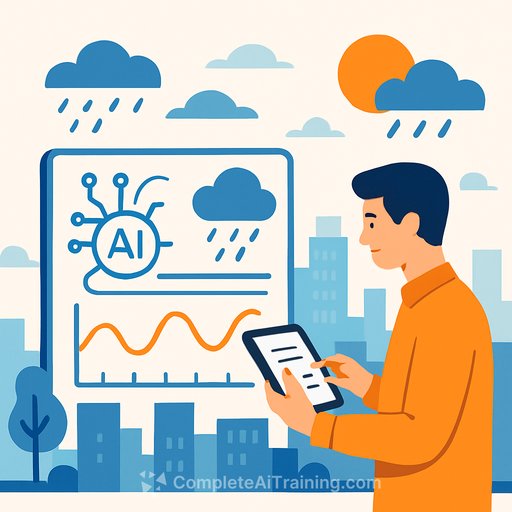
AI-driven weather forecasting is moving from brute-force computation to pattern recognition. The result: hyper-local, near real-time insights at a fraction of traditional cost. For insurers and operators, this shifts weather from a broad uncertainty to a precise, actionable signal.
Forecasts produced by AI can lower costs by up to 90% while delivering street-level precision down to 200 meters. That level of detail directly supports underwriting, exposure management, and claims readiness as climate volatility increases loss frequency and severity.
Why this matters for insurance and operations
Weather drives 60% of global property insurance losses. Traditional models refresh every 6-12 hours on kilometer-scale grids, leaving critical local conditions unseen. AI systems update in near real time and capture microclimates that determine actual loss outcomes.
For management teams, this precision improves pricing, capital allocation, and event response. It also opens the door for parametric and micro-duration covers anchored to precise, independently verifiable triggers.
How AI forecasting works vs. legacy NWP
Conventional numerical weather prediction (NWP) solves complex physics across global grids using massive compute. Despite the scale, it often misses local fog, wind shear, or sudden precipitation that matter for safety and loss control.
AI models learn patterns from decades of historical data and ongoing sensor streams. Instead of crunching equations in real time, they infer the likely evolution of local conditions and can produce 200-meter resolution outputs with far less compute, enabling faster updates and broader access.
What this unlocks for insurers and risk managers
- Underwriting: Geocode portfolios to 200 m resolution and adjust technical pricing for local hazards (e.g., convective storms, coastal fog, urban heat pockets).
- Exposure management: Track accumulations by street, not region. Shift binding authority and aggregates as conditions evolve hour by hour.
- Event response: Stage adjusters and contractors ahead of impact. Pre-authorize emergency repairs and communicate with policyholders before conditions deteriorate.
- Claims: Accelerate triage using precise impact corridors. Improve reserving accuracy and reduce loss adjustment expense.
- Parametric products: Use hyper-local triggers for precipitation, wind gusts, or visibility to reduce basis risk.
- Reinsurance and capital: Refine view of risk, improve cat model conditioning, and negotiate structures with stronger empirical support.
Aviation, transport, energy: downstream impact on insureds
Weather accounts for 30% of flight delays, costing airlines billions each year. Most forecasts describe overall airport conditions but miss runway-level wind shear or visibility shifts that drive safety and schedule reliability.
Ground transport faces similar gaps. Localized fog or bursts of precipitation increase collision risk, while better micro-forecasts enable proactive routing, staffing, and maintenance-reducing claims frequency and severity.
In energy, improved wind forecasts can lift turbine efficiency by an estimated 15% by optimizing yaw control, maintenance windows, and grid scheduling. Precision forecasting also improves solar ramp predictions and battery dispatch-stabilizing systems your commercial clients depend on.
Inside the G42-Nvidia Earth-2 initiative
G42 and Nvidia have built an AI forecasting platform via the Earth-2 Climate Tech Lab in Abu Dhabi, using a generative downscaling model to predict small-scale regional dynamics at 200 m resolution. Inception (a G42 company) adapted Nvidia's CorrDiff system to deliver highly detailed urban forecasts, and Core42 provides the Nvidia hardware stack that supports deployment.
The platform has already produced an end-to-end fog simulation across the UAE-a real test case for aviation and logistics. Leaders involved emphasize accuracy, accessibility, and the ability to adapt models to local weather behavior across regions.
Learn more about the platform at Nvidia Earth-2.
Physics AI: faster forecasts, less infrastructure
Physics-informed AI models identify atmospheric patterns using advanced data analysis rather than relying solely on heavy equation solving. This accelerates output generation and reduces dependence on supercomputers traditionally reserved for national agencies.
As compute becomes more accessible, high-resolution climate insight is no longer limited to a few institutions-enterprises can integrate it directly into operations, underwriting, and risk control.
Technology expansion to climate-vulnerable regions
G42 is extending hyper-local forecasting to Africa, South Asia, and Southeast Asia-regions that bear disproportionate climate risk. Precision precipitation and heat forecasts support farming, disaster planning, and microinsurance in areas where small deviations in weather mean large swings in outcome.
Weather-related events drive an estimated US$5 billion in annual global crop losses. For rain-fed agriculture, accurate short-term precipitation guidance can reduce crop failure, support parametric coverage, and improve food security.
Implementation checklist for insurers and operators
- Data and integration: Geocode policies and assets. Connect AI forecast APIs to underwriting, exposure, and claims systems.
- Operational playbooks: Define triggers for pre-event outreach, resource staging, and temporary binding restrictions at sub-kilometer granularity.
- Model governance: Validate forecast skill locally using backtests and event analyses. Monitor drift and recalibrate quarterly.
- Pricing and product: Introduce micro-duration covers and parametric endorsements using local triggers (wind gusts, rainfall intensity, visibility).
- Claims: Automate triage with impact corridors; pre-approve emergency services in high-probability zones to shorten cycle time.
- Partnerships: Work with airports, logistics firms, and utilities to share situational awareness and reduce correlated losses.
Key facts
- 30% - Flight delays caused by weather-related disruptions
- 90% - Forecasting cost reduction achievable with AI
- 200 m - Resolution from AI-powered forecasting
- 60% - Share of global property insurance losses tied to weather-related claims
- 15% - Potential uplift in wind energy efficiency via better forecasts
- US$5bn - Annual global crop losses due to weather-related events
What to watch next
Street-level forecasts will feed pricing and claims decisions in near real time. Expect tighter parametric triggers, improved catastrophe response, and more accurate capital deployment as managers move from regional assumptions to asset-level insight.
If you're building internal capability, you can explore practical AI upskilling paths for insurance and operations here: AI courses by job.
Your membership also unlocks: