AI-Powered Field Data Collection for Smarter Vegetation Management and a Resilient Power Grid
February 25, 2026
Vegetation-related outages drain budgets and weaken reliability. A 2019 survey found about 23% of outages were tied to overgrown vegetation. The core issue: reactive, cycle-based trimming doesn't keep pace with risk. Managers need a system that points crews to the right mile, at the right time, with evidence to back it up.
Why cycle-based trimming falls short
Fixed 3-5 year cycles treat problems after they form. That raises costs and keeps communities exposed to fires, equipment failures, and long restorations. Legal, regulatory, and reputational risks follow. The smarter move is shifting to risk-based schedules informed by live field intel, lidar, and geospatial data.
The financial toll of outdated processes
Power outages cost the U.S. economy an estimated $150B every year, and vegetation management is a significant driver. More than half of utilities say their budgets don't meet operational needs. Crews spend multiple field days per year on inspections, followed by more desk days to process photos and notes. The result is a mountain of unstructured data that's hard to standardize, analyze, and act on-without AI.
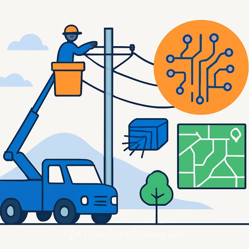
From manual cycles to data-driven decisions
Combine AI, lidar, and geospatial data to close the gap between what crews see and what leaders need to decide. Here's the practical shift.
- Guide crews with lidar and satellite-derived risk maps to focus on the highest-risk spans first.
- Turn field notes and photos into real-time signals for hazardous trees, ground-to-sky work, and access constraints.
- Move from fixed trimming to risk-based schedules that target vulnerable corridors, lower outage risk, and reduce wildfire exposure.
- Use predictive treatment plans from historical growth and weather patterns to improve compliance and stretch budgets.
- Pair machine learning and imagery to flag high-priority areas, predict fuse failures, and perform last-minute vegetation work ahead of storms.
- Equip crews with offline-capable field apps so ground truth continually improves the models and future work plans.
Proof from the field: CenterPoint Energy and LS Power
CenterPoint Energy has used lidar across transmission and distribution to run advanced analytics and physics-based simulations. By modeling wind speed and direction against vegetation and equipment, its lidar-based digital twin pinpoints the most at-risk sections and optimizes restoration priorities. Machine learning also scores site accessibility, so plans reflect both risk and recovery difficulty.
Annual reviews and multi-year comparisons track growth and asset changes with greater precision. The approach supported the Greater Houston Resiliency Initiative and delivered a 50% year-over-year reduction in vegetation-related outage minutes in 2025. Outage prediction accuracy exceeded 80%, saving millions of customer minutes of interruption.
At LS Power, shifting to high-density ground-cover conversions and targeted annual maintenance is lowering steady-state cost per acre across the ROW system. Over the next decade-plus, total vegetation management spending is projected to fall below historical levels for a comparable prior period-evidence that predictive strategies cut both risk and long-run cost.
Making the business case managers can take to the board
Preventing a single major wildfire or large outage can save hundreds of millions in liabilities and fines. One DOE-cited case showed a Midwestern cooperative cutting tree-related outages by 30%, reducing duration by 45%, and lowering trimming costs by about 80% through better tracking and analysis.
- Speed: AI and lidar complete reviews in weeks that would take months manually; automated interpretation slashes back-office time.
- Spend control: Risk-based scheduling trims where needed instead of everywhere on a clock.
- Results: CenterPoint is saving millions of CMI annually with >80% prediction accuracy. LS Power projects long-term cost reductions across its program.
- Compliance: Time-stamped, location-specific clearance records support audits under NERC vegetation management standards (FAC-003).
Operating model to implement now
- Baseline: Centralize existing lidar, satellite, patrol notes, and outage history. Clean and tag by circuit/span.
- Pilot: Select high-risk feeders or spans with poor access and recurring issues for a 90-120 day trial.
- Field capture: Roll out an offline app for photo, note, and measurement capture with auto time/location stamps.
- Models: Calibrate growth and risk models with local weather, species, and disturbance history; score each span weekly or monthly.
- Scheduling: Replace fixed cycles with a prioritized, risk-based queue that aligns with crew skills and equipment.
- Storm-readiness: Fuse failure prediction + short-fuse vegetation work for spans flagged before weather events.
- Compliance: Auto-generate clearance records, work verification, and audit packets from the same data pipeline.
Metrics management should track
- Vegetation-related SAIDI/SAIFI and CMI (trend monthly and seasonally).
- Model precision/recall (false positives and negatives) and outage prediction accuracy.
- Risk reduced per dollar spent and per crew-day.
- Miles surveyed by remote sensing vs. manual patrol; time-to-review per span.
- Access constraints cleared and average restoration time on high-risk spans.
- Audit readiness: percent of spans with time-stamped clearance documentation.
Questions to ask vendors
- Model performance: accuracy by corridor type, season, and vegetation class; error bars you can plan around.
- Latency: time from capture to actionable insight for a typical span and territory.
- Offline field capabilities and ease of photo/note capture with GPS tagging.
- Integration: EAM/CMMS, GIS, OMS/DMS/ADMS, and reporting tools-out of the box or custom.
- Compliance evidence: how time-stamped clearances are stored and surfaced for audits.
- Data ownership, security, and retention policies.
- Cost model: pricing by mile/span/user and expected ROI timeline by use case.
- Change management: training plans, field adoption metrics, and support SLAs.
For leaders aligning strategy and operations
If you're building the executive case, start here: AI for Executives & Strategy. For day-to-day deployment and crew impact, see AI for Operations.
Bottom line
Move from fixed cycles to risk-based vegetation management. Pair AI, lidar, geospatial data, and offline field tools to focus scarce crews where they matter most. You'll cut outage minutes, lower spend, strengthen compliance, and build a more resilient, reliable, and affordable grid.
Your membership also unlocks: