
Western States Deploy AI Cameras to Detect Wildfires Earlier
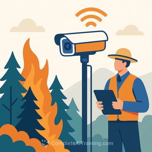
Artificial intelligence detected smoke in Arizona's Coconino National Forest on a March afternoon before any human observer spotted it. The system alerted the state's forest service and Arizona Public Service, the utility that installed the camera. Firefighters reached the Diamond Fire while it was still under 7 acres and contained it.
That early detection is the core appeal driving AI adoption across the fire-prone West. Arizona Public Service now operates nearly 40 AI smoke-detection cameras and plans to reach 71 by summer's end. Colorado's Xcel Energy has installed 126 cameras and aims to cover seven of the eight states it serves by year's end.
"Earlier detection means we can launch aircraft and personnel to it and keep those fires as small as we can," said John Truett, fire management officer for the Arizona Department of Forestry and Fire Management.
Filling Gaps in Remote Areas
The technology works best in sparsely populated, rural, or remote areas where human eyes won't spot a fire quickly. California's ALERTCalifornia network operates about 1,240 AI-enabled cameras across the state. In some cases, firefighters have responded to and extinguished fires detected by AI before receiving a single 911 call.
"The AI that's being run on the cameras is actually beating 911 calls," said Neal Driscoll, a geology and geophysics professor at UC San Diego and founder of ALERTCalifornia.
Brent Pascua, battalion chief for the California Department of Forestry and Fire Protection, said the technology is most valuable where response times matter most. "In many cases, we've started a response before 911 was even called, and in a few cases, we've actually started a response, went there, put the fire out, and never received a 911 call."
Real-World Performance and Speed Gains
Pano AI, which combines high-definition cameras, satellite data, and AI monitoring, detected 725 wildfires across the U.S. last year. The company's technology is deployed in 17 U.S. states, Australia, and Canada.
Arizona Public Service reports that the technology notifies them about 45 minutes faster on average than the first 911 call. That head start can mean the difference between a contained fire and one that spreads to hundreds or thousands of acres.
Arvind Satyam, Pano AI's co-founder and chief commercial officer, said the technology was developed in response to worsening wildfire conditions. Climate change is creating drier conditions that fuel faster, hotter, more frequent fires.
Cost and Operational Challenges
Implementation faces real obstacles. Pano AI charges around $50,000 annually per camera, including fire risk analysis and 24/7 monitoring support. That price tag limits deployment, especially for smaller agencies.
False alarms present another problem. Each alert requires human verification and can consume resources and attention.
Patrick Roberts, a senior researcher at RAND who recently completed a project on wildfire management innovation, said the technology has a fundamental limitation: it doesn't tell decision-makers what to do. "Do you send help right away? Do you monitor? Should you worry about it? Where do you send help? Do you think about evacuation? All this still requires people and decision support systems."
The AI also struggles in highly populated areas where people quickly spot fires and call them in, and in extreme weather events like hurricane-force winds that rapidly shift flames.
AI Beyond Detection
Researchers are expanding AI's role in wildfire response. George Mason University, working with California State University Los Angeles, the city of LA, and NASA's Jet Propulsion Laboratory, is developing a system to forecast where fires will burn and which communities will face the worst smoke pollution.
The goal is to give agencies real-time maps for evacuation decisions, school and road closures, and early air quality warnings. The team expects the system to be operational within three years.
AI can also identify optimal locations for vegetation thinning and controlled burns, and monitor air quality with sensitivity Roberts compared to "1,000 times more sensitive" than a home carbon monoxide detector.
Roberts said AI use in wildfires is no longer speculative. "It's really being used," he said, "and its use will only continue to grow."
Your membership also unlocks: