AI agent for urban planners
Land Use Indicator Update Agent
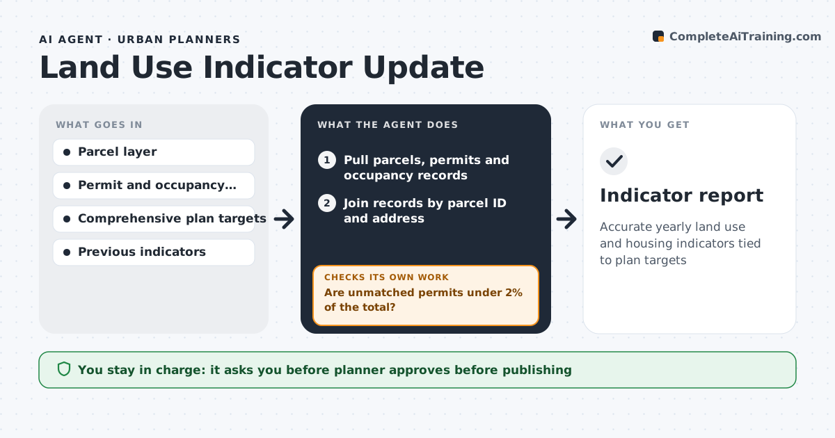
Accurate yearly land use and housing indicators tied to plan targets
What it does
Planners report on housing units built, land use changes and progress toward plan targets, and the data lives in separate systems. This agent pulls parcels, building permits and certificates of occupancy at the end of each period and joins them by parcel ID and address. It checks how many permits did not match a parcel. If more than 2% are unmatched, it matches split or merged parcels by address and lists the rest for GIS staff before going on. It then calculates land use and housing indicators, counting units at certificate of occupancy, not permit. It compares results with plan targets and the last period and drafts the indicator report with maps. The planner approves the numbers before publication. Edge case: when a large parcel was subdivided during the year, permits are matched to the new parcels by address.
How it works
Follow the arrows from top to bottom. The orange dashed arrow is the loop: when a check fails, the agent goes back and tries again.
Read the steps as a list
- Reporting period ends
- Pull parcels, permits and occupancy records
- Join records by parcel ID and address
- Are unmatched permits under 2% of the total?If not: match split or merged parcels by address and list the rest for GIS staff. Back to step 3.
- Calculate land use and housing indicators
- Compare with plan targets and last period
- Draft the indicator report with maps
- Planner approves numbers before publicationThe agent waits here for your OK.
- Indicator report
How it decides
A permit counts only when matched to a parcel. Unmatched permits above 2% of the total block the report until fixed.
- Units count at certificate of occupancy, not permit
- Unmatched rate over 2% blocks the report
- Parcel changes are matched by address
Make it yours
Every agent is a starting point. You choose these settings for your own situation.
- Unmatched threshold (default 2%)
- Indicators to report
- Plan targets to compare
- Reporting period
What keeps you in control
It always asks you first
- Planner approves before publishing
Hard limits
- Never publishes data
- Does not change source records
It stops when
- Done: indicators updated
- Stop: permit data export fails
Set it up
We guide you through the set-up, step by step
Members get the full set-up guide for this agent. No technical skills needed: you copy, paste and upload.
- One set of instructions to paste into your AI, with the clicks for ChatGPT, Claude, Microsoft 365 Copilot, Gemini and Grok
- The agent then walks you through connecting your own data, one source at a time
- A downloadable copy with the flow chart, the rules and the full guide