LiDAR classification for electric utilities: AI that turns 3D data into decisions
Electric grids are aging, and climate risk is rising. Meeting expectations for resilience, safety, and efficiency now depends on more than new hardware. It demands accurate, timely, and scalable data across vast and varied terrain. That's where LiDAR and AI-driven classification change how teams plan, maintain, and operate.
LiDAR: a high-fidelity view of your network
LiDAR captures millions to billions of precise 3D points, forming a "point cloud" of lines, structures, terrain, and vegetation. These digital models show what's in the field with measurable detail, from transmission spans and substations to slopes and canopy height. For a primer on LiDAR fundamentals, see the USGS overview here.
Why classification matters
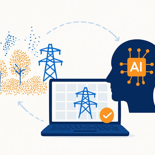
Raw point clouds are unstructured. Each point has a location, but no meaning. Classification labels points (ground, vegetation, wire, pole, structure), turning raw data into information your teams can act on.
- Vegetation management: find encroachment before it becomes a hazard and prioritize trims along critical spans. See clearance guidance in NERC FAC-003 here (PDF).
- Asset inspection: monitor wire sag, pole tilt, and equipment wear; flag anomalies for crews.
- Compliance and safety: verify regulatory clearances and structural distances at scale.
- Risk modeling: identify wildfire, flood, or storm exposure zones.
- System upgrades: inform design for new builds or capacity increases with true ground and clearance data.
Why traditional methods hit a wall
Rule-based filters, statistical models, and manual workflows can work in small, simple areas. They stall on billions of points across mixed terrain. The result: high labor cost, long turnarounds, and uneven accuracy. Even semi-automated approaches often need heavy review and rework.
AI-driven classification: faster, more precise, more scalable
Deep learning models learn from examples rather than hand-tuned rules. They detect subtle patterns, separate similar shapes (e.g., wires versus nearby branches), and pick up small or partially hidden components. They also scale from miles to regions without reprogramming, cutting processing time from weeks to hours and reducing reliance on manual edits.
Selecting the right tools (and workflow)
Match tools to your use case: data scale, terrain complexity, and accuracy targets. Many AI solutions auto-classify ground, vegetation, wires, and poles across large datasets. Advanced platforms add feature extraction for clearances, anomaly detection, and change analysis over time.
- Adopt a hybrid workflow: let AI do the heavy lift, then have experts fine-tune edge cases.
- Require QA/QC: class-level precision/recall, confusion matrices, and spot-check sampling.
- Use 3D visualization for review: accelerate triage and signoff.
- Integrate with GIS, EAM/CMMS, and outage systems to put insights in the flow of work.
Known challenges with AI adoption
High-quality training data is the lifeblood of accurate models. Labeling utility-specific features at scale is time-consuming and costly. Models trained in one geography may degrade in another, requiring retraining or domain adaptation. Rare asset types and unusual damage modes still need human oversight or custom logic.
What's next: from analysis to anticipation
AI will move classification from a task to a pipeline step that runs in the background. Predictive modeling will use historical LiDAR to forecast vegetation growth, detect early signs of conductor fatigue, and track changing fire risk. Real-time classification on drones or mobile units will speed field decisions without central processing delays. Deeper integration with GIS and asset systems will give teams a single source of truth for planning, inspection, and maintenance.
Practical rollout plan
- Define outcomes: clearance risk reduction, inspection cycle time, cost per mile, and incident rate.
- Set data standards: point density, accuracy, flight plans, coordinate systems, and metadata.
- Build a tool matrix: rate candidates on accuracy, throughput, QA features, integration, and total cost.
- Run a pilot: benchmark against manual baselines; measure precision/recall per class and review effort.
- Operationalize QA: sampling protocols, acceptance thresholds, audit trails, and reprocessing rules.
- Integrate: push outputs into GIS layers, EAM/CMMS work orders, and outage dashboards.
- Train teams: analysts on labeling and QA, engineers on interpretation, field crews on change orders.
Metrics that keep everyone honest
- Clearance violation detection rate and false-positive rate.
- Class-wise precision/recall (wires, vegetation, poles, ground).
- Turnaround time (scan-to-insight) and review hours per mile.
- Cost per mile and rework percentage.
- Regulatory findings and remediation time.
Bottom line
LiDAR gives you a precise 3D view of the electric system. AI classification turns that view into action you can schedule, track, and measure. With the right workflow, you cut risk, speed decisions, and direct crews to what matters most.
If your team is upskilling on AI workflows and data operations, explore focused training by role at Complete AI Training.
Your membership also unlocks: