Tracking Illegal Fishing in Marine Protected Areas: What Satellites and AI Reveal
Marine protected areas (MPAs) now cover over 8% of the world’s oceans. Despite this, they often face skepticism about how well they are actually protected. While MPAs are intended as safe zones for marine life, monitoring such vast and remote areas is challenging.
Recent high-profile incidents, like illegal fishing near the Galapagos Islands and vessels disabling their tracking systems, have raised concerns about the extent of unreported poaching. Yet, new global research using satellite technology and artificial intelligence shows that most industrial fishing bans within MPAs are largely respected. These tools could also enhance enforcement going forward.
What Marine Protected Areas Are Meant to Protect
MPAs protect vital habitats where marine species breed, feed, and thrive—such as coral reefs teeming with colorful fish, open oceans with fast-moving tuna, and nesting grounds for seabirds. Industrial fishing poses a major threat to these ecosystems.
Industrial fishing fleets operate worldwide, often for months or years at a time, with refrigerated cargo ships transporting catch. China operates one of the largest global fleets, reaching distant waters including the South American coast. Globally, nearly 500,000 industrial vessels harvest around 100 million metric tons of seafood annually—about five times more than in 1950.
Despite this scale, more than one-third of commercial fish species today are overfished, with populations unable to replenish naturally. Well-managed MPAs that ban industrial fishing can help restore fish populations and habitats. Research also indicates these protected zones benefit nearby fisheries through spillover effects.
This conservation approach is gaining international momentum, with most countries pledging to protect 30% of ocean areas by 2030.
Promises vs. Reality of Protection
Protection levels vary widely across MPAs. Some ban industrial fishing entirely—the highest conservation standard. Studies show these strict zones increase marine life abundance and biodiversity.
However, only about 3% of global ocean areas have full industrial fishing bans, despite over 8% being labeled protected. Many MPAs still allow destructive practices like bottom trawling, though regulations are gradually improving.
Attractive fish populations in well-protected areas can also draw poachers. For example, in 2017, a Chinese vessel was caught inside the Galápagos Marine Reserve carrying 300 tons of marine life, including 6,000 dead sharks. The crew faced heavy penalties, but many illegal operations likely go undetected.
Shining a Light on the 'Dark Fleet'
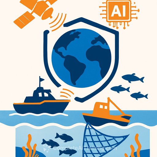
Much of what we know about fishing activity comes from the Automatic Identification System (AIS), a ship tracking technology designed to prevent collisions by broadcasting location every few seconds. By analyzing AIS data with AI, researchers can estimate when and where fishing occurs.
But AIS has limits. Vessels can switch it off, falsify data, or avoid using it. Coverage is patchy in busy regions like Southeast Asia.
New satellite tools, such as synthetic aperture radar (SAR), detect vessels regardless of AIS status by bouncing radar pulses off the ocean surface. When combined with AI, SAR reveals previously hidden fishing activity.
Though SAR struggles to detect smaller boats and provides less frequent coverage than AIS, it marks a significant improvement. Studies show about 75% of vessels detected by SAR are not visible via AIS, highlighting the "dark fleet" operating under the radar.
Global Analysis: What the Data Shows
Two studies published in Science on July 24, 2025, used AIS and SAR data to track fishing in MPAs worldwide. One study focused on nearly 1,400 MPAs—covering about 3 million square miles—where industrial fishing is explicitly banned.
The findings were clear: Most of these MPAs showed little to no industrial fishing. On average, only about five fishing vessels were detected per 100,000 square kilometers within these zones, compared to 42 in unprotected coastal waters. Furthermore, 96% of these MPAs recorded less than one day per year of suspected illegal fishing.
The second study looked at a broader set of MPAs, including those allowing some fishing. It found significantly more fishing activity—about eight times the number of detections compared to no-fishing MPAs.
These results confirm that industrial fishing bans within MPAs are generally respected. While it remains unclear whether compliance is due to strong enforcement or the placement of bans in areas with little fishing pressure, the tracking systems offer a valuable tool for detecting violations when they occur.
Reasons for Optimism
Advances in satellite monitoring and AI can reduce the costs and challenges of policing vast ocean areas. National navies and coast guards can now monitor fishing activity remotely, focusing patrols where they matter most.
Public platforms like Global Fishing Watch provide free access to vessel tracking data, increasing transparency and deterrence. For example, illegal fishing around Costa Rica's Cocos Island dropped significantly after satellite tracking tools were introduced. Similar enforcement gains are seen in the Galapagos and Mexico’s Revillagigedo National Park.
Beyond MPAs, these technologies also help monitor other human impacts on oceans, such as oil spills and deep-sea mining, supporting greater corporate accountability.
By combining satellite data and AI, we gain a clearer picture of ocean use and protection, providing practical tools to safeguard marine ecosystems more effectively.
Your membership also unlocks: