MCP server · Research
Wildfire MCP server
Lets your AI check satellite fire hotspots, weather, air quality, and land cover anywhere on Earth.
This is a helper that lets your AI look up possible wildfires around the world. It pulls together satellite fire data, weather forecasts, air pollution numbers, and land information. It is handy if you follow fires, live in a fire-prone area, or just want to know what is burning where.
What is an MCP server? The 30-second version
On its own, your AI can only chat with you. An MCP server is a small helper program that gives your AI a new skill or a connection to an outside service. This one connects your AI to wildfire and weather data sources like NASA FIRMS, OpenWeatherMap, and Google Earth Engine. Once it is set up, you can just ask your AI a question and it will go fetch the answer for you.
What this MCP server does
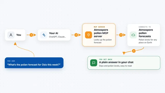
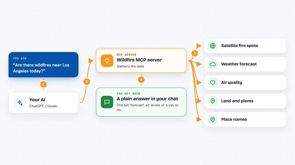
You ask your AI something like whether there are fires near a place you care about. Your AI passes that question to this helper. The helper then talks to the satellite and weather services, gathers the matching data, and hands it back. Your AI turns that into a plain answer in the chat, like a list of hotspots or a short weather outlook. You do not have to visit any of those websites yourself.
 Click to zoom
What you can do with it
- Check for active fire hotspots on a chosen date
- Filter fires by how intense they are
- Limit the search to a country or a box on the map
- Get a 5-day weather forecast for a spot
- See current and past air pollution levels
- Turn coordinates into a readable address
- Check whether a place has vegetation that can burn
Try asking your AI
- “Are there any wildfires in Iran today?”
- “Show me fire hotspots near these coordinates: 34.05, -118.24”
- “What is the weather forecast for the next few days at 37.77, -122.42?”
- “What is the air pollution level right now in this area?”
What it gives back to you
You get answers in plain chat text. That can be a list of fire hotspots with their intensity, a short weather forecast, air pollution numbers, or a yes or no about whether a spot has burnable vegetation. Sometimes it also gives you a readable address for a pair of coordinates. Everything shows up as a normal reply from your AI.
Before you start
What you need
- A NASA FIRMS map key (free from the NASA FIRMS site)
- An OpenWeatherMap API key (a kind of password for apps; the site gives you one for free)
- Google Earth Engine credentials if you want the land cover checks
- Python and the ability to run a small program on your computer or a server
Good to know
Fire data comes from satellites and can be wrong or incomplete, so always check official sources before acting on it.
Install it with your AI
Add Wildfire MCP server to your AI, no technical skills needed
You don't install anything by hand. You copy one prompt, paste it into an AI that can work on your computer, and it checks, installs and connects the server for you, asking you when it needs something.
Sign in to get the install prompt
Members get a ready-made prompt that lets the Claude desktop app check Wildfire MCP server, install it and connect it for them, step by step. You don't need any technical skills: you copy, paste and answer a few questions. Your connected AI can also find and install any of the 4,361 MCP servers here for you.
Who it's for
People who track wildfires, researchers, journalists, and anyone curious about fires and air quality in a specific region.