MCP server · Analytics
GIS MCP server
by mahdin75
Let your AI do map and location maths: distances, areas, buffers, map layers and coordinate changes.

This is a helper that gives your AI assistant skills for working with maps and location data. It can measure distances, draw areas around points, change between map coordinate systems, and read map files. It is handy if you work with locations, maps, or any data that has a place attached to it.
What is an MCP server? The 30-second version
On its own, your AI can only chat. It cannot open a map file or measure a distance on the ground. An MCP server is a small helper program that gives your AI a new skill. This one connects your AI to GIS tools, which are the standard programs people use to work with maps and location data. Once it is connected, you can just ask your AI a location question and it will use these tools to work it out for you.
What this MCP server does
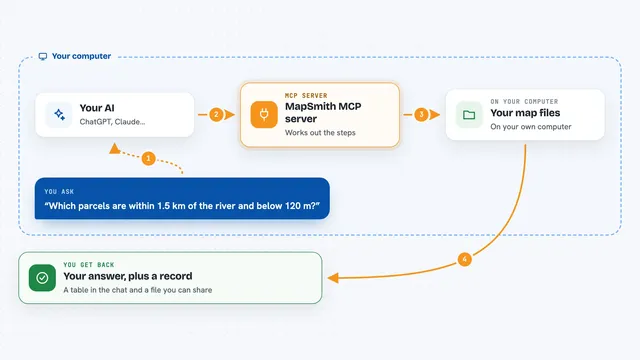
You ask your AI something about places or maps, like how far apart two points are. Your AI passes that request to this helper program. The helper uses well known map libraries to do the actual calculation or file reading. Then it sends the answer back, and your AI explains it to you in the chat. You do not need to install or understand those map libraries yourself.
 Click to zoom
What you can do with it
- Measure distances, areas and lengths between places
- Draw a buffer zone around a point or a shape
- Change coordinates from one map system to another
- Combine or compare two map shapes, like finding where they overlap
- Read and work with map files such as shapefiles and raster images
- Make a simple map or an interactive web map
- Check whether a map shape is valid and fix it if not
Try asking your AI
- “How far is it in kilometres between these two coordinates?”
- “Draw a 5 kilometre buffer around this point and show me the result”
- “Convert these coordinates from one map system to another”
- “Which of these two areas overlap, and by how much?”
What it gives back to you
You get answers in the chat: numbers like distances or areas, short summaries of what it found, or a new map file it saved for you. For map output it can produce a static image or an interactive web map, depending on what you ask. If it changed a shape or a file, it tells you what it did.
Before you start
What you need
- Python 3.10 or newer installed on your computer
- An MCP-compatible app such as Claude Desktop or Cursor
- For interactive maps, the extra visualization packages (installed with a small add-on command)
Good to know
It can create, change and delete files in the folder you point it at, so keep it aimed at a folder you do not mind it writing to.
Install it with your AI
Add GIS MCP server to your AI, no technical skills needed
You don't install anything by hand. You copy one prompt, paste it into an AI that can work on your computer, and it checks, installs and connects the server for you, asking you when it needs something.
Sign in to get the install prompt
Members get a ready-made prompt that lets the Claude desktop app check GIS MCP server, install it and connect it for them, step by step. You don't need any technical skills: you copy, paste and answer a few questions. Your connected AI can also find and install any of the 4,361 MCP servers here for you.
Who it's for
People who work with maps, locations or place-based data, such as planners, analysts, researchers and students.