MCP server · Research
AtlasFetch MCP server
Turn coordinates into country, region and municipality names, and check them against your own map areas.
AtlasFetch is a service that answers a simple question: what place is this coordinate in? This MCP server connects that service to your AI assistant, so you can paste a latitude and longitude into the chat and get back a real place name with official country and region codes. It is handy for anyone who works with location data, spreadsheets of coordinates, delivery zones or service areas.
What is an MCP server? The 30-second version
On its own, your AI can only chat. It cannot look up a real place on a map, and if you ask it which town a coordinate is in, it is guessing from memory. An MCP server is a small helper program that gives your AI a new skill. This helper connects your AI to AtlasFetch, a location lookup service, so when you ask about a coordinate, the AI actually asks AtlasFetch and gives you the real answer.
What this MCP server does
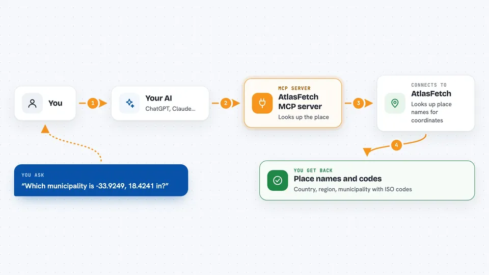
You paste a coordinate into your chat and ask which place it is. Your AI passes that coordinate to this helper program. The helper sends it to AtlasFetch, which does a real point-in-polygon lookup against boundary data. AtlasFetch sends back the country, region and municipality names with their official ISO codes, and any of your own map areas that contain the point. Your AI then shows you that answer in the chat, in plain words.
 Click to zoom
What you can do with it
- Turn a latitude and longitude into a country, region and municipality
- Get official ISO 3166 country and region codes for a coordinate
- Check whether a coordinate falls inside one of your own map areas
- Create a new set to hold your own polygons
- Add a GeoJSON polygon to one of your sets
- List your boundary sets and how many polygons each one has
- Ask for the nearest street to a coordinate (beta, opt-in)
Try asking your AI
- “Which municipality is -33.9249, 18.4241 in?”
- “What country and region code is 51.5007, -0.1246?”
- “Is 40.7128, -74.0060 inside any of my delivery zones?”
- “List my boundary sets and tell me how many polygons each has”
What it gives back to you
You get back a short block in the chat: the country, region and municipality names, each with its ISO code, for example United Kingdom (GB), England (GB-ENG), City of Westminster (GB-WSM). If you asked about your own map areas, you also see which of them matched, along with any properties you stored on them. If you asked for the street layer, you get the nearest street name and distance, at three different search distances. If nothing matches, you are told that too, rather than being left guessing.
Before you start
What you need
- Node.js 20 or newer on your computer
- An AtlasFetch API key from atlasfetch.xyz/dashboard (free, no card needed). Without one it uses a shared demo key capped at 1,000 lookups a month across all anonymous users.
Good to know
Each lookup counts against your monthly quota even if it matches nothing, and a brand new boundary set cannot be made queryable from this server, so you still need to finish that step in the AtlasFetch dashboard.
Install it with your AI
Add AtlasFetch MCP server to your AI, no technical skills needed
You don't install anything by hand. You copy one prompt, paste it into an AI that can work on your computer, and it checks, installs and connects the server for you, asking you when it needs something.
Sign in to get the install prompt
Members get a ready-made prompt that lets the Claude desktop app check AtlasFetch MCP server, install it and connect it for them, step by step. You don't need any technical skills: you copy, paste and answer a few questions. Your connected AI can also find and install any of the 4,361 MCP servers here for you.
Who it's for
People who work with coordinates, delivery zones, service areas or region codes, such as analysts, operations staff and anyone tidying up a spreadsheet of locations.