MCP server · Research
DaedalMap MCP server
by xyver
Lets your AI turn coordinates and area codes into real places, and pull disaster, currency and population data.
DaedalMap is a service that connects locations to data. You give it a point on the map or a code like a county number, and it tells you which places that matches and what data goes with them. It is handy if you work with spreadsheets full of locations, disaster reports, or numbers that need to line up with real areas.
What is an MCP server? The 30-second version
On its own, your AI can only chat. It cannot look up which county a coordinate falls in or fetch earthquake records. An MCP server is a small helper that gives your AI one new skill. This one connects your AI to DaedalMap, so when you ask a geography or data question, your AI can go and get the answer for you.
What this MCP server does
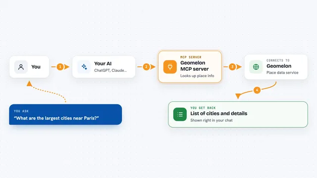
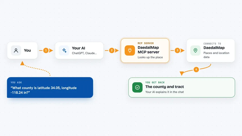
You ask your AI something about places or location data. Your AI passes your question to the DaedalMap helper. The helper looks up the right geography, data pack, or crosswalk on DaedalMap's servers. Then it sends back the matching places, numbers, or shapes, and your AI explains the result to you in the chat. You never have to open a map site or a data file yourself.
 Click to zoom
What you can do with it
- Turn a latitude and longitude into the country, state, county and tract it sits in
- Look up which disaster events are recorded for a place
- Pull maintained data packs like earthquakes, hurricanes, wildfires, floods and currency rates
- Translate codes from one geography system to another, such as postal areas to census tracts
- Compare two areas and see how they overlap
- Fetch the boundary shapes for a country or region
- Check what a column of location codes in your file actually refers to
Try asking your AI
- “What county and census tract is latitude 34.05, longitude -118.24 in?”
- “Show me recent earthquake events in California”
- “What is the current exchange rate pack showing for EUR to USD?”
- “How do postal areas in this list line up with census tracts?”
What it gives back to you
You get answers in plain chat: place names, matched codes, lists of events, numbers from a data pack, or short summaries. For shapes, it returns geometry you can use in a map tool. If a call needs payment, it tells you the exact price before anything is charged.
Before you start
What you need
- The DaedalMap MCP address, which is free to add and needs no account for small lookups
- An API key and account credit only if you want larger batches or paid data packs
Good to know
Larger point batches and some data packs are paid, so check the price it shows before you confirm, and remember that data packs carry their own source licenses.
Install it with your AI
Add DaedalMap MCP server to your AI, no technical skills needed
You don't install anything by hand. You copy one prompt, paste it into an AI that can work on your computer, and it checks, installs and connects the server for you, asking you when it needs something.
Sign in to get the install prompt
Members get a ready-made prompt that lets the Claude desktop app check DaedalMap MCP server, install it and connect it for them, step by step. You don't need any technical skills: you copy, paste and answer a few questions. Your connected AI can also find and install any of the 4,361 MCP servers here for you.
Who it's for
People who work with location data, spreadsheets of area codes, disaster or risk reporting, or anyone who needs to line up numbers with real places.